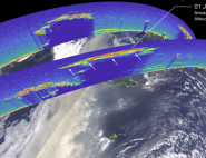
Not all clouds are alike
Clouds are classified using Latin words (cirrus: a lock of hair, stratus: layer, cumulus: heaped, nimbus: rain), which describe their appearance or altitude. We normally distinguish between four types:
- High clouds or cirriforms (found at altitudes of between 5 and 13 kilometres). Cirrus, cirrostratus and cirrocumulus, which all belong in this category, consist of millions of minute ice crystals and not water droplets like clouds at lower altitudes. They have a temperature of less than –40°C.
- Mid-level clouds (at altitudes of 2 to 6 kilometres). Altostratus and altocumulus fall into this category. The first consist of both ice crystals and droplets of water. They cover huge surface areas, sometimes hundreds of square kilometres. Although they only produce a small amount of precipitation, altostratus often indicate that more is on the way. As for altocumulus, they resemble tall columns of cotton wool.
- Low clouds or stratiforms (from ground level up to an altitude of 2 kilometres). The stratus, stratocumulus and nimbostratus clouds which make up this category generally consist of droplets of liquid water. Unlike cumulus, stratus clouds develop horizontally and form just a few metres above the ground. Stratocumuli are grey, sometimes with very dark shadows and are spread out like a layer of cotton. Finally, nimbostrati form a dark grey layer under which rain or snow falls. They can be up to 3 kilometres thick.
- Very thick clouds or cumuliforms, which cannot be classified in any of the above three categories, due to their vast vertical extent. These include cumulus, which resemble isolated cotton wool balls suspended in the blue sky, and cumulonimbus, which consist of droplets of liquid water at the base and ice crystals at the top. Also known as the "king of clouds" and often in the shape of an anvil, a cumulonimbus cloud can reach an altitude of 12 kilometres—even higher than Mount Everest.
| Low cloud: strong albedo effect, weak infrared effect. | High cloud (cirrus): weak albedo effect, strong infrared effect. | Deep cloud (Cumulonimbus): strong albedo effect, strong infrared effect. |
Depending on which category they belong to, different clouds have varying effects on radiation. The radiative effect of clouds on the global energy budget is estimated by comparing a situation "with clouds" to the same situation "without clouds". As a result, the most significant effects correspond to situations with the greatest contrasts between the Earth's surface and the clouds. For example, thick, highly reflective clouds above the sea create an increased parasol effect, whereas high and therefore very cold clouds, over a warm surface, would have a maximum greenhouse effect.
Consequently, it is important to observe two particular categories of clouds:
- stratocumulus, which permanently cover 20% of the Earth's surface (particularly above the oceans in mid-latitudes and to the east of oceans in tropical regions), because they have a limited greenhouse effect due to their low attitude, but a considerable parasol effect;
- cirrus, because they have a significant greenhouse effect, due to their high altitude and low temperature, but a minimal parasol effect since they are transparent, or even sub-visible.